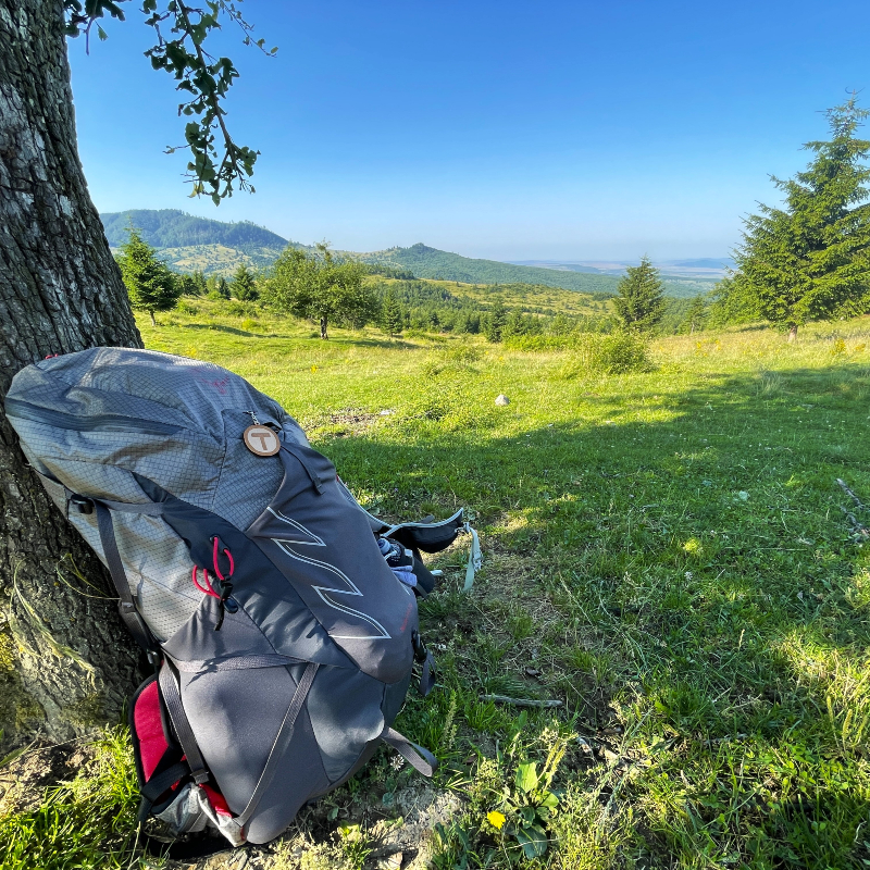
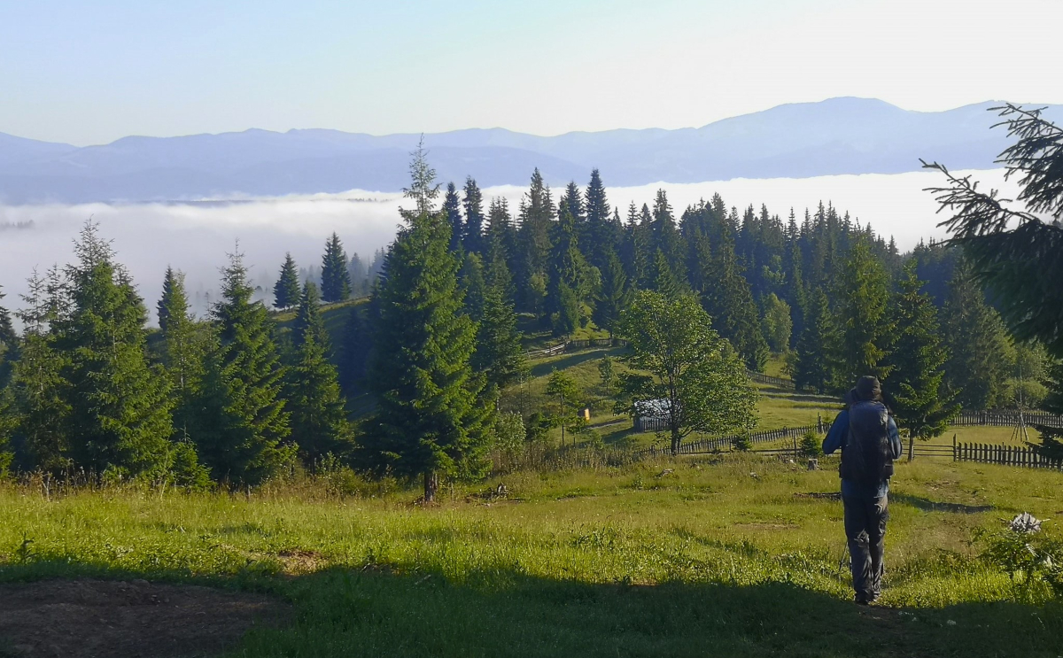
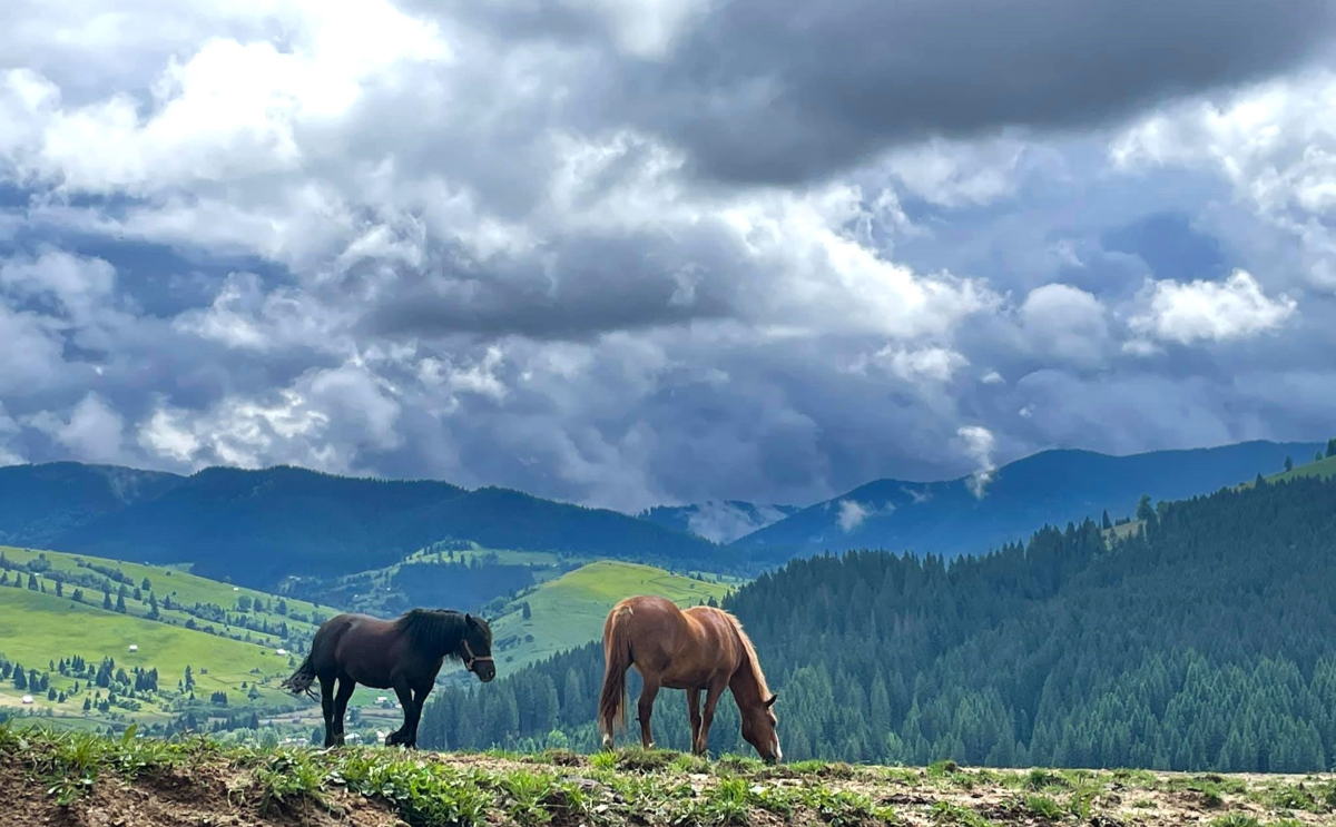
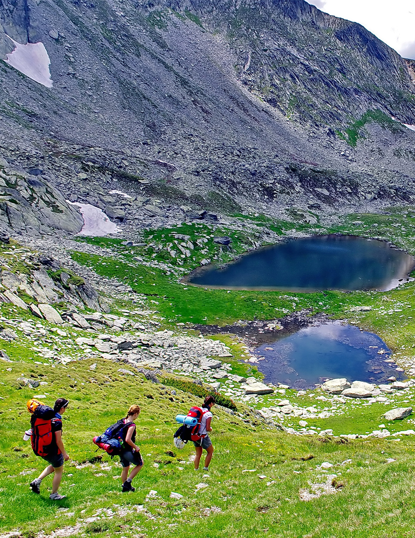
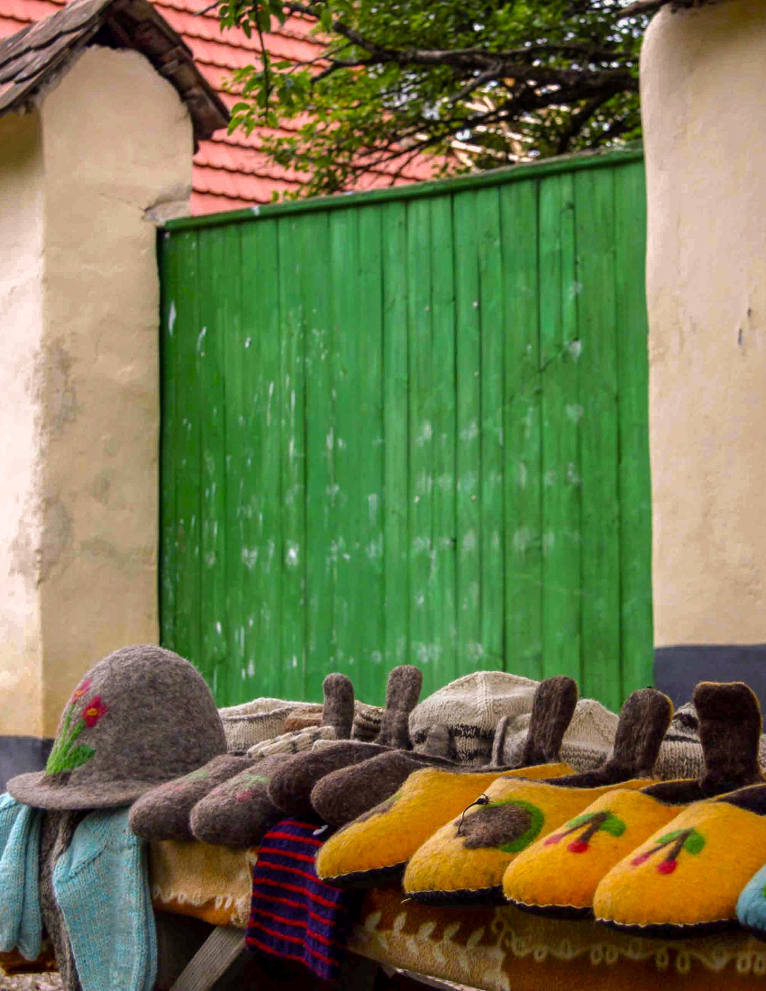
Via Transilvanica – a road about Transylvania’s identity. Trekking, by bike or on horseback - your choice!

Discover yourself along the trails!

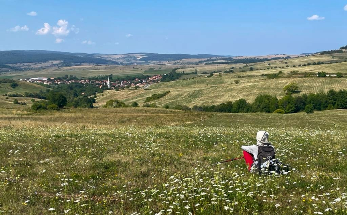
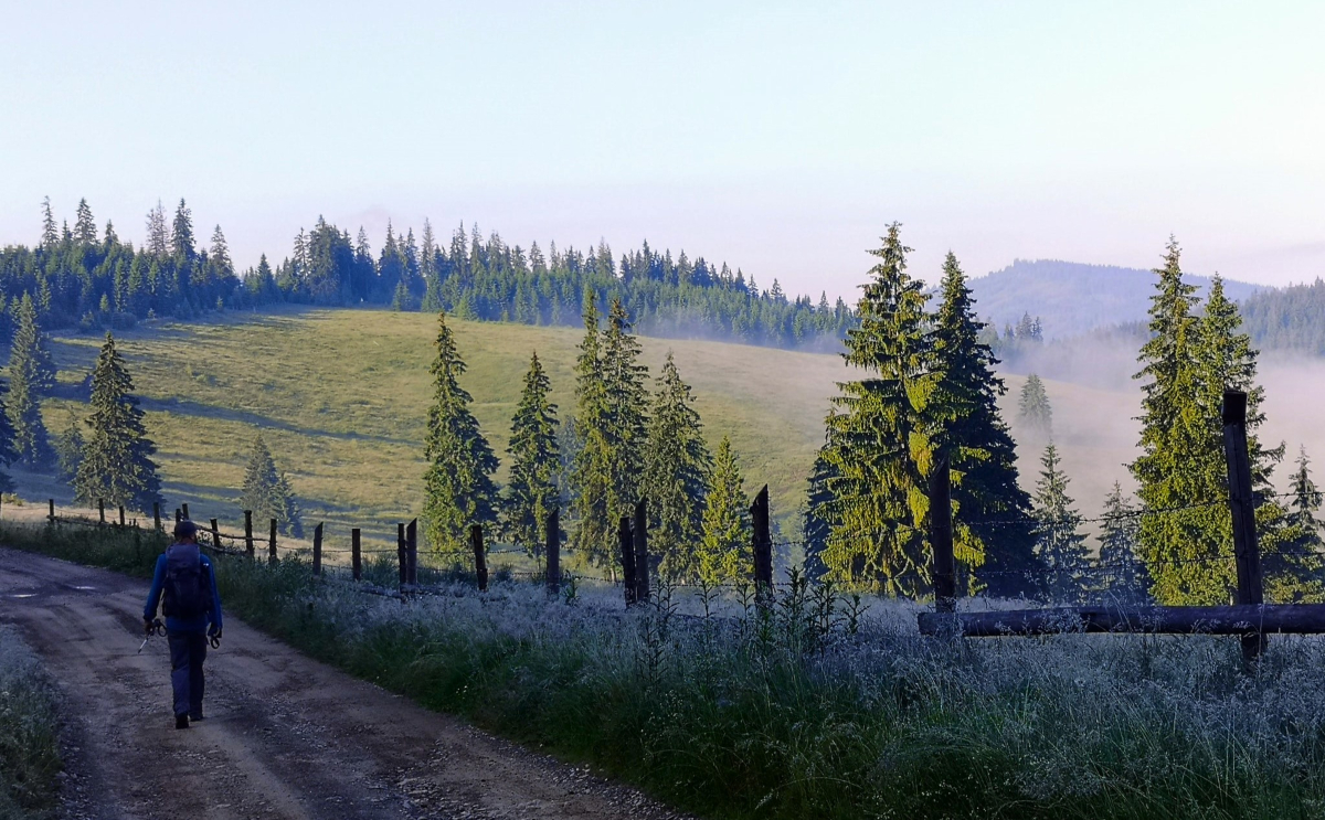
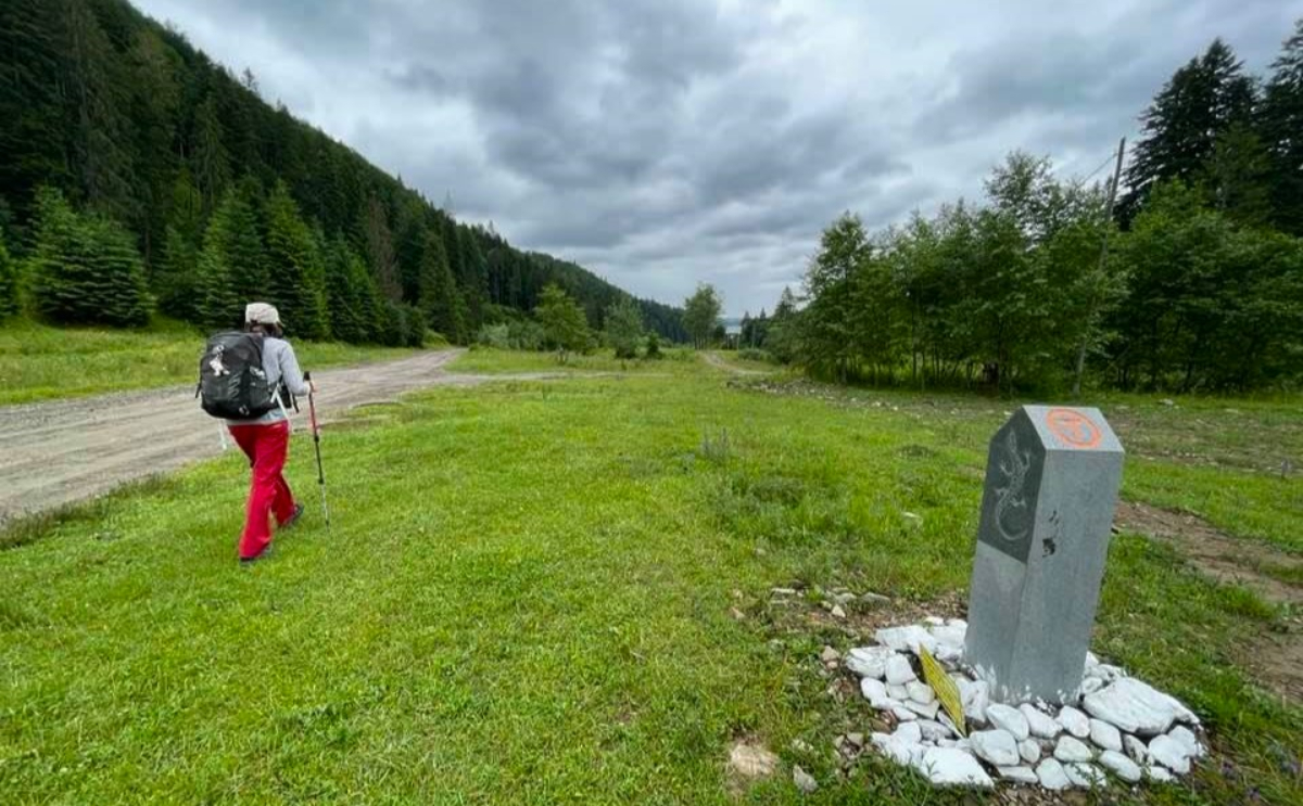
Let’s travel together on Via Transilvanica, a long-distance trails which highlights all the natural, historical and ethnic features that characterize Transylvania. The 1,400 km route - inspired by Spain’s Camino - crosses Romania from North to South, winding through 108 villages and towns along the way. The route is split up into 7 key regions, each with unique flavor and attraction.

Via Transilvanica is about discover the nature, the people and the history of Transylvania. And, nevertheless is a about to discover yourself. It gives you chances to discover your inner truth and strength while walking along the paths off the beaten track. Either you make the whole length, or just a portion of it, the sensation you’ll fell cannot be explained in words. The route can be crossed on foot, by bicycle or on horseback.

By bike, the average time for a daily run is considered by covering the distance of two trekking days.

The journey starts in the historical region of Bucovina: a green scenery rich in wildlife in a remote land, inhabited harmoniously by several ethnic groups.

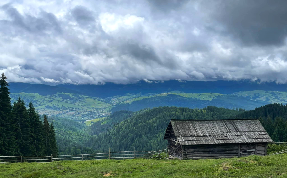
The Highland is dedicated to mountain enthusiasts who love the endless pastures and wild mountains, former shelter for outlaws whose legends will be revealed by the locals you get in touch with.

Terra Siculorum. One of the most appreciated section, covering the Szeklerland; the region is inhabited by the Székely population, a Hungarian speaking ethnic group, which settled in Transylvania starting to the 11th century.

Terra Saxonum (Saxonland) is probably the most famous rural area of Transylvania, inhabited in the Middle Ages by German colonists since the 12 century. Discover their immemorial heritage!

Terra Dacica speaks about the Romanian ancestors, their customs and traditions, the fortifications and a remote land with dense forests and savage animals.

Terra Banatica. The beauty of this place and its natural resources attracted during the Middle Age populations of Hungarians, Czechs, Jews, Greeks, Serbs and Armenians which lived and worked in the area in a fair harmony.

Terra Romana. The trail runs in a spectacular scenery, from the Danube River to the Cerna Mountains, passing through Domogled National Park, one of the most spectacular in the country. Stunning landscapes, remote and rare villages - just a couple of attractions of this section.

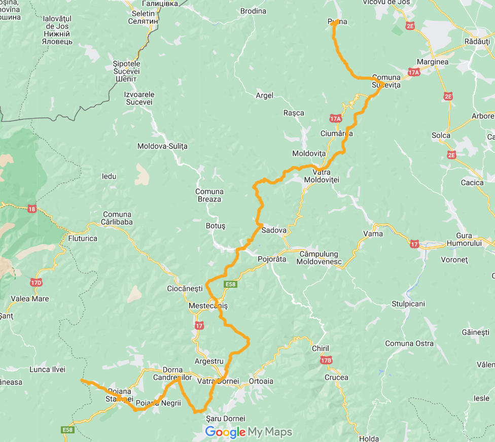
Bucovina

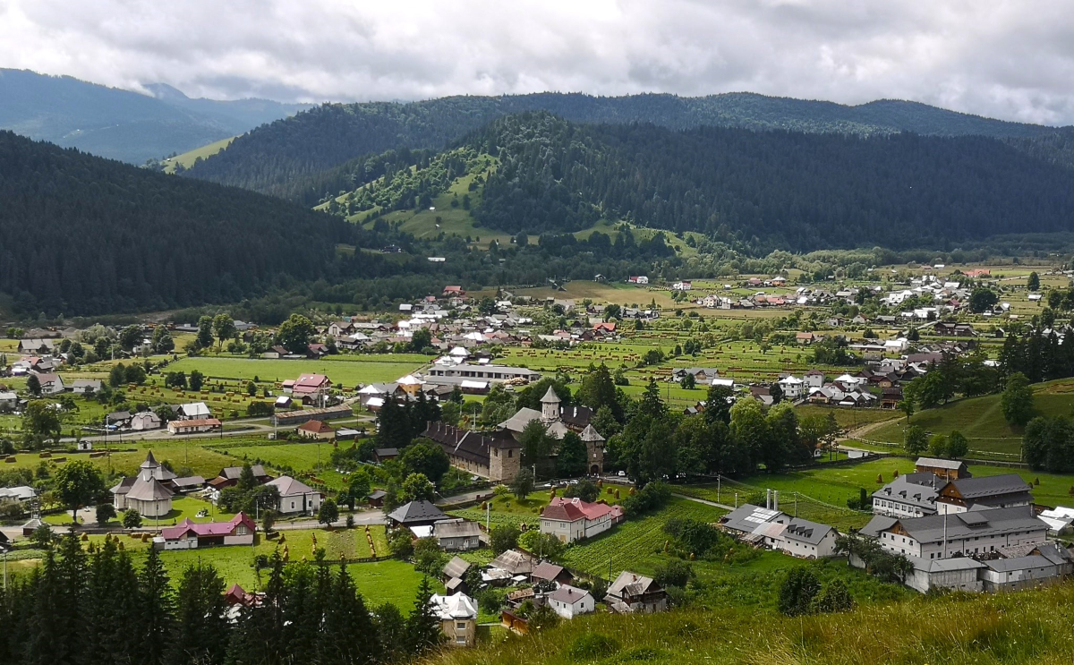
The journey starts in the historical region of Bucovina: a green scenery rich in wildlife in a remote land, inhabited harmoniously by several ethnic groups. Good chances to get in contact with the rural life: warm people having vivid traditions, inherited since old times.

The section could be completed in 7 days, enough to get a beautiful insight of the region: trekking, leisure, attractions visit.


Highlights:

- the UNESCO painted monasteries of Moldovita (1532) and Sucevita (1583),

- Putna monastery (1466, the burial place of the most famous leader of Moldova, Stephen the Great),

- Fundu Moldovei commune – a famous keeper of the old rural traditions,

- Dorna Candrenilor area – rich in mineral water springs,

- Tihuta mountain pass (1200m alt) – stunning viewpoint of the surrounding mountains, houses scattered on the hills.


Details:

Day 1. Putna – Sucevita. Aprox. trekking time: 6,30 hr, distance: 19,5km.

Day 2. Sucevita – Vatra Moldovitei. Aprox. trekking time: 8,30 hr, distance: 21km.

Day 3. Vatra Moldovitei – Sadova. Aprox. trekking time: 9,30 hr, distance: 22,5km.

Day 4. Sadova – Pasul Mestecanis. Aprox. trekking time: 7,30 hr, distance: 22km.

Day 5. Pasul Mestecanis – Vatra Dornei. Aprox. trekking time: 7 hr, distance: 22km.

Day 6. Vatra Dornei – Poiana Negrii. Aprox. trekking time: 7,30 hr, distance: 22km.

Day 7. Poiana Negrii – Lunca Ilvei. Aprox. trekking time: 8 hr, distance: 24km.


Accommodation in rural 3* B&B’s with HB (local traditional food).

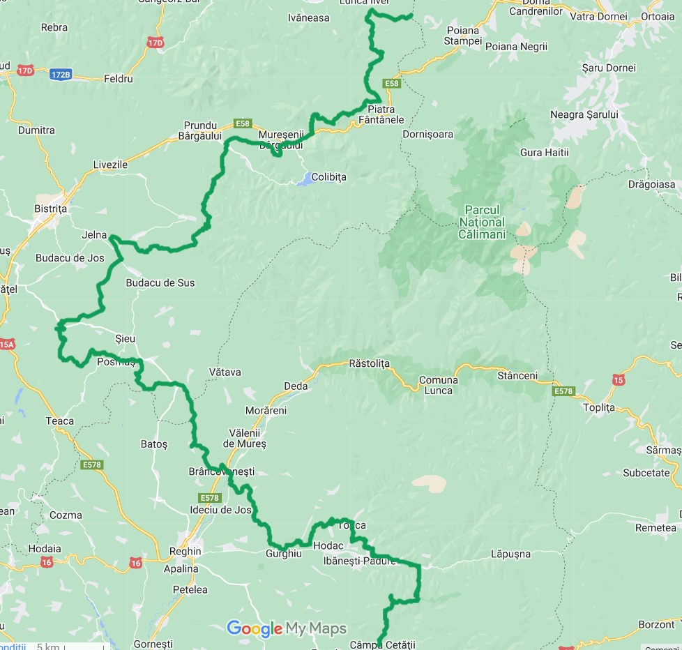
Highland

This part takes 10 days and it is dedicated to mountain enthusiasts who love the endless pastures and wild mountains, former shelter for outlaws whose legends will be revealed by the locals you get in touch with.

The route starts from Tihuta pass (1200m), then climb the volcanic Calimani mountains (beautiful rock landscape, remains from the old volcanic activity); the next stage follows the Mures hills, downhill to Sovata resort.

This is the longest section of the route (around 220km), covering a harsh region, inhabited by people used to the hard climate conditions.


Highlights:

- Teleki castle ruins in Posmus village (founded by German colonists in the 13th century),

- the violin craft tradition from Reghin area,

- the Forest of Lowland (natural reserve) from Orheiul Bistritei – rare tulip species and secular oak forests,

- Sovata spa resort (officially certified in 1884) : the region is rich in salt and thermal waters underground, some of the natural formed lakes being heliothermal, like Ursu (the largest from Europe of its kind), or Alunis.


Details:

Day 1. Lunca Ilvei – Tasuleasa Social. Aprox. trekking time: 9,30 hr, distance: 18km.

Day 2. Tasuleasa Social – Bistrita Bargaului. Aprox. trekking time: 9 hr, distance: 25km.

Day 3. Bistrita Bargaului – Petris. Aprox. trekking time: 10 hr, distance: 25km.

Day 4. Petris – Jeica. Aprox. trekking time: 9 hr, distance: 28km.

Day 5. Jeica – Monor. Aprox. trekking time: 7 hr, distance: 22km.

Day 6. Monor – Brancovenesti. Aprox. trekking time: 5 hr, distance: 14,5km.

Day 7. Brancovenesti – Casva. Aprox. trekking time: 6,5 hr, distance: 20km.

Day 8. Casva – Bradetel. Aprox. trekking time: 8 hr, distance: 23km.

Day 9. Bradetel – Campu Cetatii. Aprox. trekking time: 7 hr, distance: 20,5km.

Day 10. Campu Cetatii – Sovata. Aprox. trekking time: 6 hr, distance: 17km.


Accommodation in mountain chalets and rural 3* B&B’s with HB (local traditional food).

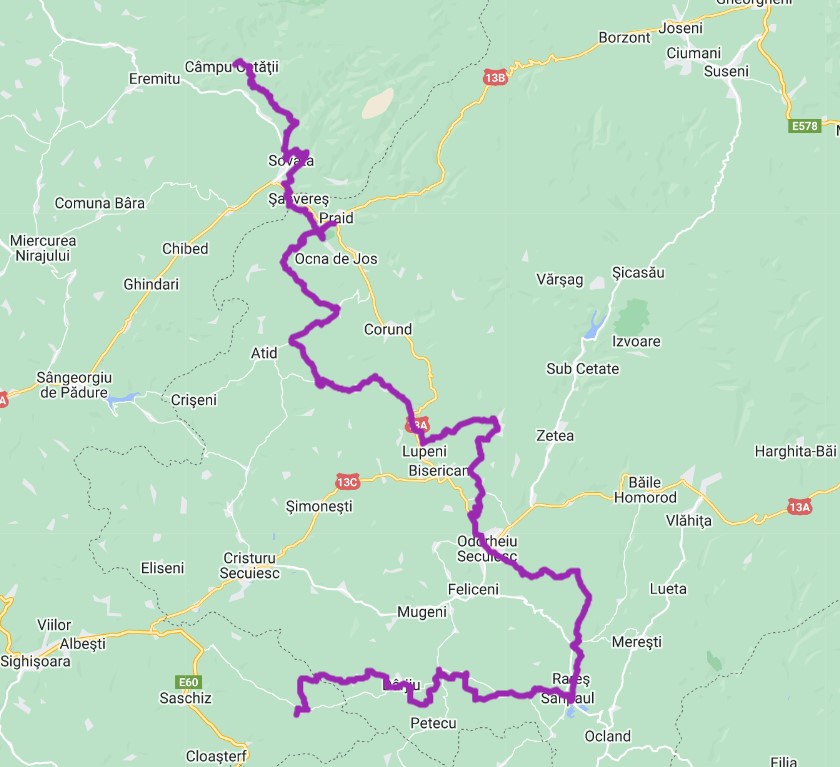
Terra Siculorum

One of the most appreciated section, covering the Szeklerland; the region is inhabited by the Székely population, a Hungarian speaking ethnic group, which settled in Transylvania starting to the 11th century.

The villagers are hospitable and eager to welcome or host visitors. The region preserves also a few fortified churches belonging to the Unitarian church. The general view of the rural landscape follows a series of lowlands, combined with large rolling hills covered by oak forests and green pastures. Worth mentioning about the Szeklerland is also the local architecture involving houses with traditional gates and hand-painted furniture, the ceramic culture from Corund (famous in Romania), and a delicious local cuisine.


Highlights:

- Sovata spa resort (officially certified in 1884) : the region is rich in salt and thermal waters underground, some of the natural formed lakes being heliothermal, like Ursu (the largest from Europe of its kind), or Alunis.

- Mocanita train: 2 hours of ride along narrow gauge line, carrying the passengers back in time

- Praid Salt Mine (documented since 1200) and the Salt Canyon; probably the deepest salt mountain form Europe – 3km deep, and also the largest in Europe; one section of the mountain is cut by a valley, revealing the salt formations (massive cliffs and ridges, sinkholes and small salt caves where the landscape changes constantly) – aka the Salt Canyon.

- Corund village – famous for pottery products decorated with fine patterns in white and blue; the area is the only place in the country where products made of tinder or iasca (mushroom growing on tree trunks) are produced; another attraction here is the Aragonit, found where the water rich in minerals get into chemical reactions with the limestone, thus creating the semiprecious stone;

- The volcanic plateau formations – proofs of an intense past volcanic activity which hosts rich wildlife in the forests or the open lands, as well as the charcoal makers from Calonda (outdoor traditional activity);

- Mini Transylvania Park from Odorheiu Secuiesc - displaying at a small scale some of the most important historical buildings from Romania, many of them being included in UNESCO World Heritage Site.

- The Natural Reserve "Popasul Păsărilor de la Sânpaul” (​​10 ha), a wetland area protecting and conservating the migratory and nesting birds, some of which being protected at European level or on the IUCN red list.


Details:

Day 1. Sovata – Praid. Aprox. trekking time: 6 hr, distance: 17km.

Day 2. Praid – Atia. Aprox. trekking time: 5 hr, distance: 16km.

Day 3. Atia – Lupeni. Aprox. trekking time: 8 hr, distance: 24km.

Day 4. Lupeni – Odorheiul Secuiesc. Aprox. trekking time: 8 hr, distance: 24km.

Day 5. Odorheiul Secuiesc – Martinis. Aprox. trekking time: 6,30 hr, distance: 19km.

Day 6. Martinis – Darjiu. Aprox. trekking time: 9 hr, distance: 30km.

Day 7. Darjiu – Archita. Aprox. trekking time: 5 hr, distance: 16km.


Accommodation in rural 3* B&B’s with HB (local traditional food).

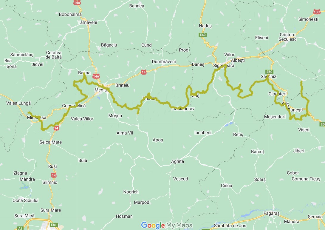
Terra Saxonum

Probably the most famous rural area of Transylvania, inhabited in the Middle Ages by German colonists. Granted with several privileges, they settled at the Hungarian king’s initiative starting to the 12th century, in order to develop the region. They brought plans for neighborhood arrangements, organized agriculture, and equal administrative and political rights; during the time they build massive fortified churches – strongholds to protect against invasions, some of them being included in UNESCO Word Heritage Site.

The route concludes at least 6 days and starts at Archita, close to the unconventional limit between the historical areas of Szeklely, at East and Saxons, at West and ends at Medias, one of the seven important medieval Saxon cities, hence the German name of Transylvania – Siebenbürgen.

The trail follows one of the most extensive flower-rich grasslands remaining in lowland Europe, essentially unchanged for hundreds of years, in which low intensity agriculture coexists with an abundance of flora and fauna. This is one of Europe’s last medieval landscapes - forested ridges and gullies pasture and hay meadows on gentler slopes and terraces, and arable land and smaller meadows on the flat valley bottoms near villages. The Saxon villages have remained unchanged in structure and largely unchanged in size for many centuries; if once there were about 800,000 people, nowadays the amount is reduced at about 100,000 scattered in 150 villages and settlements. Low intensity agriculture coexists with an abundance of flora and fauna, including many nationally and internationally threatened species.

The Transylvanian region of Saxony is also called Haferland - "The Land of the Oats" as one of the local species cultivated oats, due to the supportive climate. With the help of various German foundations, Haferland Week is organized every year in order to draw attention to the beauty and diversity of the region and to recall the old cultural values, customs, and crafts of the Saxons.


Highlights:

- Crit: the first stop during the trek; Crit village preserves a community renowned for its unity; the "Slanina" Tower/ Bacon Tower, which appears in almost every village with a fortified church, is an example of where the entire community stores its winter supplies. The tower would open on Sunday or Saturday, and people took food from there to last them for a week, without touching any of the other's provisions.

- Saschiz: admire the UNESCO peasant fortress overlooking the village from the northern hilltop, or the fortified church with its towers resembling the organization of the community – the School tower, the Voivode tower, the Priest’s tower, the Gate tower, the Ammunition tower and the Guard tower; take a break and stop for a refreshment, including the famous rhubarb or elderflower jams, prepared by following old Saxon recipes;

- Sighisoara: one of the 7th main cities of the Saxons, mentioned in 1280, included in UNESCO as the last European citadel still inhabited; the city represents an important settlement of merchants, the guilds being mentioned as early as 1376. Admire the narrow cobbled streets, named after the former guilds, the defensive towers and bastions (including the famous Clock tower – the city symbol), the Lutheran Gothic churches – the Monastery church and the Church from the Hill (1345), or the boutique cafes and terraces where you can have a relaxant rest.

- Biertan. The village is one of the seven Saxon places included in UNESCO World Heritage. Admire the imposing 16th cent Lutheran church, built on a hill in the middle of the village, surrounded by three belts: the defensive towers are named accordingly to different use: the Clock tower, the Catholic tower, the Bacon tower, the Weavers bastion, the Funeral tower, the Prison tower or the Town hall

- Medias. Another main Saxon city, the former capital of the Weinland, attested since 1267. The city has preserved its history testimonies through the 17 towers and bastions, multi-secular walls over 7 meters high, 3 main gates and 4 secondary access gates to the old fortress. Saint Margaret's fortified church has valuable Gothic mural paintings and the tilted tower with a clock that shows the moon phases. Vlad Tepes (Dracula) was imprisoned in the church in 1476. The neighboring region is rich in wineries, hence the symbol of grapes, carved out of many of the city’s houses.


Details:

Day 1. Archita – Crit. Aprox. trekking time: 8 hr, distance: 24km.

Day 2. Crit – Saschiz. Aprox. trekking time: 4,5 hr, distance: 14km.

Day 3. Saschiz – Sighisoara. Aprox. trekking time: 6 hr, distance: 19km.

Day 4. Sighisoara – Malancrav. Aprox. trekking time: 7,5 hr, distance: 24km.

Day 5. Malancrav – Biertan. Aprox. trekking time: 5,30 hr, distance: 16,5km.

Day 6. Biertan – Medias. Aprox. trekking time: 10 hr, distance: 30km.

Day 7. Medias - Micasasa. Aprox. trekking time: 13 hr, distance: 42km.


Accommodation in rural 3* Guesthouses and B&B’s with HB (local traditional food).

Terra Dacica

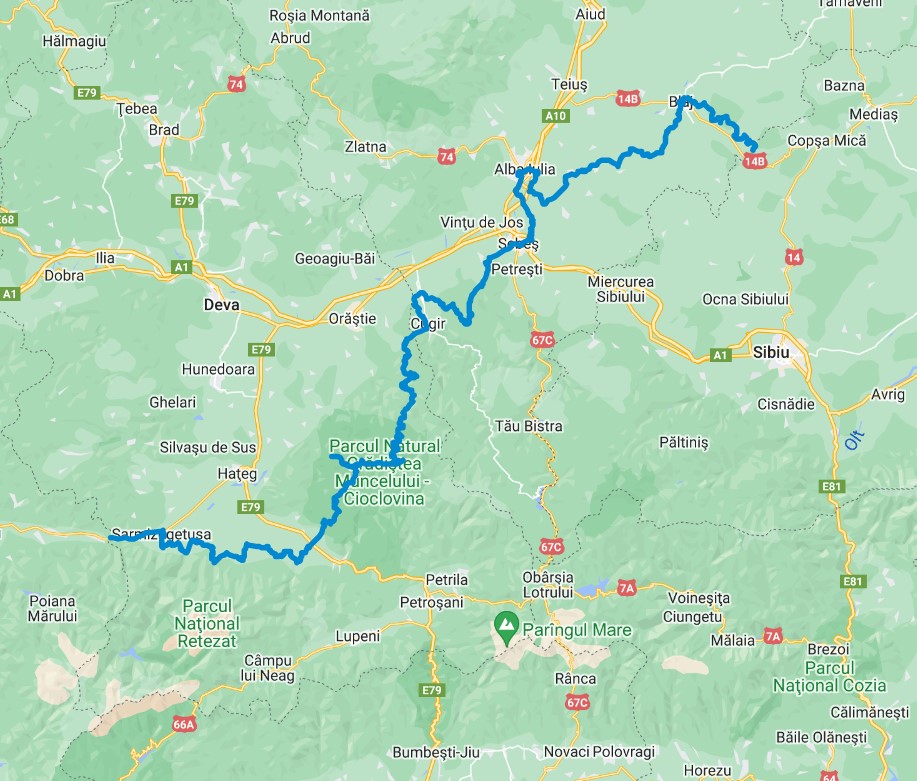
We are now on a long route of about 270 kilometers, which includes the part of Via Transilvanica in Alba and Hunedoara counties, going up to the highest altitude of its entire route, at 1242 meters.

Here we discover a perfect combination of gentle hills with oak and other deciduous forests, vineyards in the famous Târnave area, and also vast yellow fields with rapeseed in spring, or sunflower, during the summer. The white limestone landforms from Sureanu Mountains surprises the travelers with their spectacular formations, as caves, steep and rocky walls, or gorges.

The trail follows three protected areas: Retezat Mountains (National Park, included in UNESCO), Grădiștea Muncelului-Cioclovina (Natural Park) and Tara Hațegului (Geopark). We also find here traces and the identity of the ancient Romania and its ancestors, as well as testimony of the territorial unification.

The people are welcoming and the food is rich and tasty. There are a few dishes that reminding us about the real Transylvania: the lard with onion, the goat, or sheep-beef sausages (virsli) and the double distilled brandy (52 degr). In this land you can also find sober boar steaks, typical Saxon stew or the classic Hungarian-influenced Transylvanian paprikas, necessarily seasoned with acid and simple wines from Tarnave vineyard.


Highlights:


- Blaj city. The first Romanian textbooks were printed here, the Romanian language was taught in schools for the first time, and the first theater performances in the country were organized here in 1761. The Freedom Square - during the Revolution of 1848, the square was located outside the town of Blaj and was chosen as the meeting place for 40,000 Romanian peasants from all regions of Transylvania. During the Great Assembly in Blaj (May 15-17, 1848), the representatives of the crowd drew up a petition demanding democratic rights for Romanians (abolition of serfdom, right to speech and press, education in Romanian etc.), sent later to Emperor Ferdinand I of Austria.

- Alba Iulia city. Represent a foray into the past, with testimonies of the last 2,000 years of our living. We mention first the ruins of the Roman fort Apullum, then the Roman-Catholic Cathedral it its 1200 years of existence, then the historical moments of unification declarations from 1599 and 1918, also the Orthodox Cathedral were Maria and Ferdinand were crowned in 1922 as Kings of Great Romania. Nevertheless, another important attraction is the entire citadel that houses the above-mentioned sites, the largest fortress in Romania and the biggest Vauban type construction from Europe. Then, a valuable cultural eestablishment, the Batthyaneum Library, housed in the building of the former Trinitarian monastery, which dates from the early 18th century. An active seeker could find here a collection that comprises 80% of the total of medieval western manuscripts in Romania (over 1500 pieces), including the Codex Aureus, the oldest western manuscript in the country (approx. 810), over 45,000 old and rare books printed in Europe in the 16th -18th centuries, 70% of all incunabula in Romania.

- The Red Ravine (Rapa Rosie) – an interesting geological formation, created by the erosion of water and wind during the last 60 million years. The river Secaș dug deeply through the layers of gravel, sandstone and quartz and created the impressive relief that still changes its appearance today. Protected area since 1968

- Sebes. The city itself was built by German settlers — later referred as Transylvanian Saxons (the former name - Muhlbach), but actually originating from the region of Rhine and Moselle — on the territory of the Hungarian Kingdom in the second half of the 12th century and became an important city in medieval Transylvania. Its city walls were reinforced after the Tatar (Mongol) invasions from 1241–1242, but the city was occupied in 1438 by the Ottoman Empire. A royal deed from 1387 enshrines the right of Sebeș to build fortress walls, so later the city becomes, despite its small size, the first in Transylvania to be completely surrounded by masonry fortifications.

- The Dacian fortress of Sarmizegetusa Regia (included in UNESCO World Cultural Heritage). It represents the most important military, political and religious centre, capital of Dacia, before the Roman conquest in 106 AD. The fortress was made up of three parts: the civil settlements (to the east and west of the fortress proper - now extinct), the fortress and the sacred area. Inside, traces of iron-working workshops or traces of a system for capturing, filtering and storing water have been discovered. The sacred area is the most complex and well-preserved temple area of any Dacian fortress, including seven sanctuaries.

- The small medieval fortress of Mălăiesti (14th cent) is located in Hațeg lowland, at the foot of the Retezat mountains. It had a role of defense and surveillance, and the donjon, the highest of the towers, was used as a place of firing and shelter. The fortress has a ring enclosure, 3 polygonal towers (observation tower, flanking tower and one at the gate) and a belfry.


Details:

Day 1. Micasasa – Blaj. Aprox. trekking time: 10hr, distance: 30km.

Day 2. Blaj – Straja. Aprox. trekking time: 9hr, distance: 27km.

Day 3. Straja– Alba Iulia. Aprox. trekking time: 7,5hr, distance: 24km.

Day 4. Alba Iulia – Sebes. Aprox. trekking time: 6 hr, distance: 20km.

Day 5. Sebes – Vinerea. Aprox. trekking time: 10 hr, distance: 30km.

Day 6. Vinerea – Ciungu Mare. Aprox. trekking time: 6 hr, distance: 22km.

Day 7. Ciungu Mare – Gradistea de Munte. Aprox. trekking time: 12 hr, distance: 35km.

Day 8. Gradistea de Munte – Ponor. Aprox. trekking time: 12 hr, distance: 35km.

Day 9. Ponor – Nucsoara. Aprox. trekking time: 7 hr, distance: 24km.

Day 10. Nucsoara – Ulpia Traiana Sarmizegetusa. Aprox. trekking time: 6 hr, distance: 22km.


Accommodation in rural 3* Guesthouses and B&B’s with HB (local traditional food).

Terra Banatica

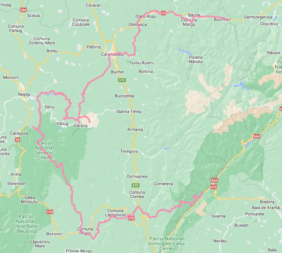
This section of Via Transilvanica route has almost 230km long and passes through the enchanting mountainous Banat region, crossing the Semenic – Cheile Carașului National Park and passing by the edge of two other national parks, Cheile Nerei – Beusnita and Domogled – Valea Cernei. It also represents a strange combination of wild nature with memories of mining and heavy industry, today almost extinct. The travelers will come across a history related to factories and plants, most of which have become memories. Likewise, they will come across extinct ethnicities or villages (almost) erased by time from the face of the earth – as Lindenfeld, Ravensca , or Eibenthal.

During the first days, the travelers will experience several former industrial cities, an opportunity to notice their evolution after the closure of the steel factories till the present day.

Given the small gradient of most trails along the route, less active trekkers have a good chance of actually finishing most trails on the route. And if you dare to try this route by mountain bike, the distances will seem even shorter!

Among the attractions along the way we could mention the Caraș Gorges, the Izvoarele Nerei UNESCO reserve, the Comarnic Cave, the Croatian village of Carașova, Poiana Mărului lake & meadow, Gozna or Trei Ape lakes.

Highlights:

- Boutari-Subcetate rack railway, built in 1908 in the attempt to establish a direct connection between the heavy industry in full expansion from Resita and the large coal deposits related to  Jiului valley. The railway used the connection mountain pass (Poarta de Fier a Transilvaniei) between the Western Hills to Hateg lowland.

- The fantastic Semenic – Cheile Carașului National Park. It has waters, caves, lakes, gorges, and nature is lush; it was established in 1982, being one of the 13 national parks in Romania. It has an area of over 36000ha, contains the longest and wildest gorges in Romania, Caras (20km), includes 8 nature reserves and the largest area of quasi-virgin forest in Europe, over 5000ha hectares, including 350-year-old trees. The galleries and halls from Comarnic Cave total a length of 5.229 m

- Oravita – Anina railway. It is the oldest railway from South-East Europe. Also known as 'Semmeringul Banatean', the line has been in use since 1869. The distance between Oraviţa and Anina is 33 kilometers and along the way the train crosses 14 tunnels and 10 viaducts.

- The Banat rural region has inhabited by a large diversity of migrants during the Middle Ages, being brought here by the Habsburg Empire. Many ethnicities gathered here, cohabited, collaborated, and lived in good understanding. We meet here not only Romanians, but also Serbs, Croatians, Germans, Hungarians, Jews, Bulgarians, Italians, Greeks, Armenians or Turks. During the journey we shall notice their villages with fortified houses and wide streets, straight sidewalks and flowerbeds in front of the gate.

- The mix of cultures and ethnic groups has created a special, sophisticated and opulent cuisine. One can mention the sweetness of hot peppers, the zacusca spread, some Banatian salad with mushrooms and vegetables, pecanari sausages at Cornereva style, paprikas at Nițchidorf style or goat's cheese sprinkled with pepper. You can also taste their well-known sweetened sauces and soups, but also scholarly steaks or pilafs dressed with herbs and paprika. Sophisticates in love with gastronomy mention wine varieties with exotic names such as Creata de Teremia Mare, Cadarca de Miniș or Mustoasa de Măderat.


Details:

Day 1. Ulpia Traiana Sarmizegetusa – Marga. Aprox. trekking time: 4 hr, distance: 18km.

Day 2. Marga – Var. Aprox. trekking time: 5 hr, distance: 20km.

Day 3. Var – Poiana. Aprox. trekking time: 10 hr, distance: 30km.

Day 4. Poiana – Garana. Aprox. trekking time: 6 hr, distance: 20km.

Day 5. Garana – Lacul Secu. Aprox. trekking time: 10 hr, distance: 30km.

Day 6. Lacul Secu – Resita. Aprox. trekking time: 6 hr, distance: 18km.

Day 7. Resita – Iabalcea . Aprox. trekking time: 6,5 hr, distance: 20km.

Day 8. Iabalcea – Semenic Mts (camping). Aprox. trekking time: 8 hr, distance: 23km.

Day 9. Semenic Mts – Prigor. Aprox. trekking time: 8 hr, distance: 27km.

Day 10. Prigor – Crusovat. Aprox. trekking time: 10 hr, distance: 30km.


Accommodation in rural 3* Guesthouses and B&B’s with HB (local traditional food).

Terra Romana

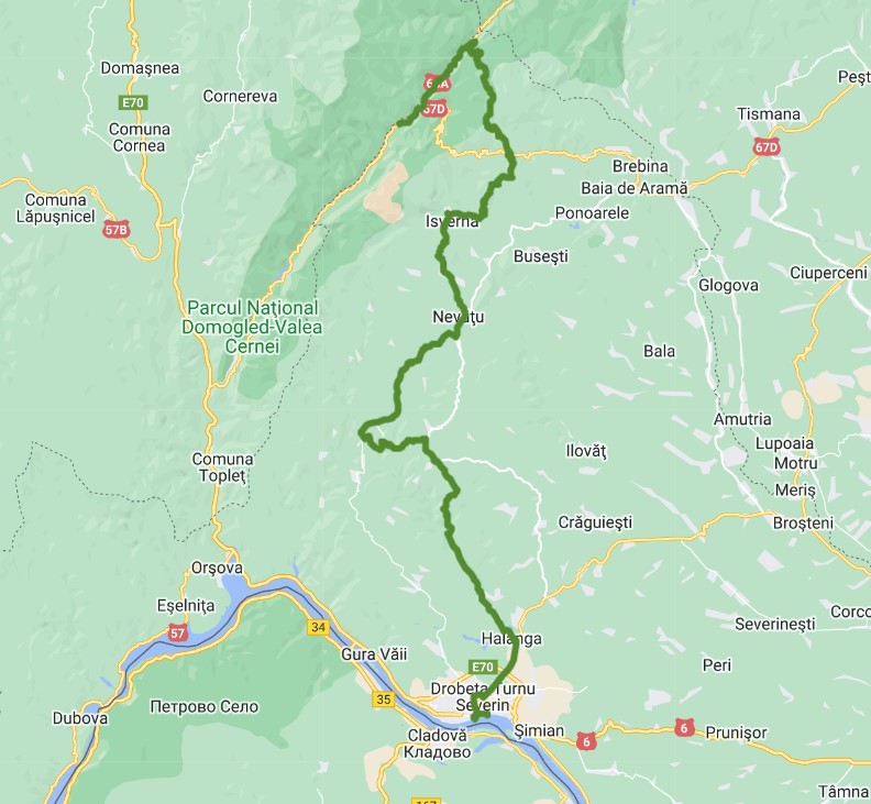
This is the shortest route from Via Transilvanica, almost 200km, stretched from the Danube river (Iron Gates) through Mehedinti Plateau and then Cerna Mountains. Most of the journey runs through one of the most spectacular national parks in Romania, Domogled-Valea Cernei National Park. The park's geographical richness includes unique caves, limestone peaks, thermal mineral springs, mountain reservoirs, subalpine meadows and more than 100 species of plants and animals, including many rarities. Here you can find more than 30 mountain trails, beech forests, alpine hollows with junipers and canyons with streams with a strongly intermittent flow. The protected area covers over 60000ha in 11 nature reserves, protected with the aim of protecting and conserving habitats and important natural species from a flora, fauna, forestry, hydrological, geological, speleological, paleontological, pedological aspect.

The Mehedinți rocky plateau is an unexplored land, in some of its places. It is that happy combination between water and rock, between the mountain peaks and the sweeping curves of the vine-covered hills. Here there are still herds of sheep that, during the summer, go up to the mountains, and at the end of it go down to the villages at the foothills, to the shelter offered by the smallest relief unit in Romania, the Mehedinți Plateau.

The world is ancestral, a melange of different ethnic groups, something that gives it a special charm. Remote and isolated villages, scattered in the mountains pops up, from time to time, during our trek.

At the end of the 1800s, the population of Drobeta-Turnu Severin, the main city from Danube region, was predominantly German-speaking, and Hungarians, Czechs, Jews, Greeks, Serbs and Armenians lived and worked in the area.

Speaking of gastronomy, here is the homeland of sour soups and corn flower derivatives, a creative kitchen, where vegetables such as peppers stuffed with potatoes, sugar beets or aubergines can take on unfamiliar forms, turning into dishes that can be given exotic names such as moussaka or duck. It's a different world, where Serbian plešcavita meets fish soup made with Danube water, but here we also have geagik, the local version of the Greek tsatsiki salad. Also familiar to the place are braga, halvita, baklava or sherbet, all of Turkish origin.


Details:

Day 1. Crusovat – Glamping Camp Arjana/Dobraia. Aprox. trekking time: 4 hr, distance: 18km.

Day 2. Glamping Camp Arjana/Dobraia – Cerna valley (km35). Aprox. trekking time: 5 hr, distance: 20km.

Day 3. Cerna valley (km35) – Obarsia Closani. Aprox. trekking time: 5 hr, distance: 15km.

Day 4. Obarsia Closani – Balta. Aprox. trekking time: 6 hr, distance: 25km.

Day 5. Balta – Ciresu. Aprox. trekking time: 4 hr, distance: 14km.

Day 6. Ciresu - Drobeta Turnu Severin. Aprox. trekking time: 10 hr, distance: 35km.


Accommodation in rural 3* Guesthouses and B&B’s with HB (local traditional food).


Description

Let’s travel together on Via Transilvanica, a long-distance trails which highlights all the natural, historical and ethnic features that characterize Transylvania. The 1,400 km route - inspired by Spain’s Camino - crosses Romania from North to South, winding through 108 villages and towns along the way. The route is split up into 7 key regions, each with unique flavor and attraction.

Via Transilvanica is about discover the nature, the people and the history of Transylvania. And, nevertheless is a about to discover yourself. It gives you chances to discover your inner truth and strength while walking along the paths off the beaten track. Either you make the whole length, or just a portion of it, the sensation you’ll fell cannot be explained in words. The route can be crossed on foot, by bicycle or on horseback.

By bike, the average time for a daily run is considered by covering the distance of two trekking days.

The journey starts in the historical region of Bucovina: a green scenery rich in wildlife in a remote land, inhabited harmoniously by several ethnic groups.

The Highland is dedicated to mountain enthusiasts who love the endless pastures and wild mountains, former shelter for outlaws whose legends will be revealed by the locals you get in touch with.

Terra Siculorum. One of the most appreciated section, covering the Szeklerland; the region is inhabited by the Székely population, a Hungarian speaking ethnic group, which settled in Transylvania starting to the 11th century.

Terra Saxonum (Saxonland) is probably the most famous rural area of Transylvania, inhabited in the Middle Ages by German colonists since the 12 century. Discover their immemorial heritage!

Terra Dacica speaks about the Romanian ancestors, their customs and traditions, the fortifications and a remote land with dense forests and savage animals.

Terra Banatica. The beauty of this place and its natural resources attracted during the Middle Age populations of Hungarians, Czechs, Jews, Greeks, Serbs and Armenians which lived and worked in the area in a fair harmony.

Terra Romana. The trail runs in a spectacular scenery, from the Danube River to the Cerna Mountains, passing through Domogled National Park, one of the most spectacular in the country. Stunning landscapes, remote and rare villages - just a couple of attractions of this section.

Bucovina

The journey starts in the historical region of Bucovina: a green scenery rich in wildlife in a remote land, inhabited harmoniously by several ethnic groups. Good chances to get in contact with the rural life: warm people having vivid traditions, inherited since old times.

The section could be completed in 7 days, enough to get a beautiful insight of the region: trekking, leisure, attractions visit.


Highlights:

- the UNESCO painted monasteries of Moldovita (1532) and Sucevita (1583),

- Putna monastery (1466, the burial place of the most famous leader of Moldova, Stephen the Great),

- Fundu Moldovei commune – a famous keeper of the old rural traditions,

- Dorna Candrenilor area – rich in mineral water springs,

- Tihuta mountain pass (1200m alt) – stunning viewpoint of the surrounding mountains, houses scattered on the hills.


Details:

Day 1. Putna – Sucevita. Aprox. trekking time: 6,30 hr, distance: 19,5km.

Day 2. Sucevita – Vatra Moldovitei. Aprox. trekking time: 8,30 hr, distance: 21km.

Day 3. Vatra Moldovitei – Sadova. Aprox. trekking time: 9,30 hr, distance: 22,5km.

Day 4. Sadova – Pasul Mestecanis. Aprox. trekking time: 7,30 hr, distance: 22km.

Day 5. Pasul Mestecanis – Vatra Dornei. Aprox. trekking time: 7 hr, distance: 22km.

Day 6. Vatra Dornei – Poiana Negrii. Aprox. trekking time: 7,30 hr, distance: 22km.

Day 7. Poiana Negrii – Lunca Ilvei. Aprox. trekking time: 8 hr, distance: 24km.


Accommodation in rural 3* B&B’s with HB (local traditional food).

Highland

This part takes 10 days and it is dedicated to mountain enthusiasts who love the endless pastures and wild mountains, former shelter for outlaws whose legends will be revealed by the locals you get in touch with.

The route starts from Tihuta pass (1200m), then climb the volcanic Calimani mountains (beautiful rock landscape, remains from the old volcanic activity); the next stage follows the Mures hills, downhill to Sovata resort.

This is the longest section of the route (around 220km), covering a harsh region, inhabited by people used to the hard climate conditions.


Highlights:

- Teleki castle ruins in Posmus village (founded by German colonists in the 13th century),

- the violin craft tradition from Reghin area,

- the Forest of Lowland (natural reserve) from Orheiul Bistritei – rare tulip species and secular oak forests,

- Sovata spa resort (officially certified in 1884) : the region is rich in salt and thermal waters underground, some of the natural formed lakes being heliothermal, like Ursu (the largest from Europe of its kind), or Alunis.


Details:

Day 1. Lunca Ilvei – Tasuleasa Social. Aprox. trekking time: 9,30 hr, distance: 18km.

Day 2. Tasuleasa Social – Bistrita Bargaului. Aprox. trekking time: 9 hr, distance: 25km.

Day 3. Bistrita Bargaului – Petris. Aprox. trekking time: 10 hr, distance: 25km.

Day 4. Petris – Jeica. Aprox. trekking time: 9 hr, distance: 28km.

Day 5. Jeica – Monor. Aprox. trekking time: 7 hr, distance: 22km.

Day 6. Monor – Brancovenesti. Aprox. trekking time: 5 hr, distance: 14,5km.

Day 7. Brancovenesti – Casva. Aprox. trekking time: 6,5 hr, distance: 20km.

Day 8. Casva – Bradetel. Aprox. trekking time: 8 hr, distance: 23km.

Day 9. Bradetel – Campu Cetatii. Aprox. trekking time: 7 hr, distance: 20,5km.

Day 10. Campu Cetatii – Sovata. Aprox. trekking time: 6 hr, distance: 17km.


Accommodation in mountain chalets and rural 3* B&B’s with HB (local traditional food).

Terra Siculorum

One of the most appreciated section, covering the Szeklerland; the region is inhabited by the Székely population, a Hungarian speaking ethnic group, which settled in Transylvania starting to the 11th century.

The villagers are hospitable and eager to welcome or host visitors. The region preserves also a few fortified churches belonging to the Unitarian church. The general view of the rural landscape follows a series of lowlands, combined with large rolling hills covered by oak forests and green pastures. Worth mentioning about the Szeklerland is also the local architecture involving houses with traditional gates and hand-painted furniture, the ceramic culture from Corund (famous in Romania), and a delicious local cuisine.


Highlights:

- Sovata spa resort (officially certified in 1884) : the region is rich in salt and thermal waters underground, some of the natural formed lakes being heliothermal, like Ursu (the largest from Europe of its kind), or Alunis.

- Mocanita train: 2 hours of ride along narrow gauge line, carrying the passengers back in time

- Praid Salt Mine (documented since 1200) and the Salt Canyon; probably the deepest salt mountain form Europe – 3km deep, and also the largest in Europe; one section of the mountain is cut by a valley, revealing the salt formations (massive cliffs and ridges, sinkholes and small salt caves where the landscape changes constantly) – aka the Salt Canyon.

- Corund village – famous for pottery products decorated with fine patterns in white and blue; the area is the only place in the country where products made of tinder or iasca (mushroom growing on tree trunks) are produced; another attraction here is the Aragonit, found where the water rich in minerals get into chemical reactions with the limestone, thus creating the semiprecious stone;

- The volcanic plateau formations – proofs of an intense past volcanic activity which hosts rich wildlife in the forests or the open lands, as well as the charcoal makers from Calonda (outdoor traditional activity);

- Mini Transylvania Park from Odorheiu Secuiesc - displaying at a small scale some of the most important historical buildings from Romania, many of them being included in UNESCO World Heritage Site.

- The Natural Reserve "Popasul Păsărilor de la Sânpaul” (​​10 ha), a wetland area protecting and conservating the migratory and nesting birds, some of which being protected at European level or on the IUCN red list.


Details:

Day 1. Sovata – Praid. Aprox. trekking time: 6 hr, distance: 17km.

Day 2. Praid – Atia. Aprox. trekking time: 5 hr, distance: 16km.

Day 3. Atia – Lupeni. Aprox. trekking time: 8 hr, distance: 24km.

Day 4. Lupeni – Odorheiul Secuiesc. Aprox. trekking time: 8 hr, distance: 24km.

Day 5. Odorheiul Secuiesc – Martinis. Aprox. trekking time: 6,30 hr, distance: 19km.

Day 6. Martinis – Darjiu. Aprox. trekking time: 9 hr, distance: 30km.

Day 7. Darjiu – Archita. Aprox. trekking time: 5 hr, distance: 16km.


Accommodation in rural 3* B&B’s with HB (local traditional food).

Terra Saxonum

Probably the most famous rural area of Transylvania, inhabited in the Middle Ages by German colonists. Granted with several privileges, they settled at the Hungarian king’s initiative starting to the 12th century, in order to develop the region. They brought plans for neighborhood arrangements, organized agriculture, and equal administrative and political rights; during the time they build massive fortified churches – strongholds to protect against invasions, some of them being included in UNESCO Word Heritage Site.

The route concludes at least 6 days and starts at Archita, close to the unconventional limit between the historical areas of Szeklely, at East and Saxons, at West and ends at Medias, one of the seven important medieval Saxon cities, hence the German name of Transylvania – Siebenbürgen.

The trail follows one of the most extensive flower-rich grasslands remaining in lowland Europe, essentially unchanged for hundreds of years, in which low intensity agriculture coexists with an abundance of flora and fauna. This is one of Europe’s last medieval landscapes - forested ridges and gullies pasture and hay meadows on gentler slopes and terraces, and arable land and smaller meadows on the flat valley bottoms near villages. The Saxon villages have remained unchanged in structure and largely unchanged in size for many centuries; if once there were about 800,000 people, nowadays the amount is reduced at about 100,000 scattered in 150 villages and settlements. Low intensity agriculture coexists with an abundance of flora and fauna, including many nationally and internationally threatened species.

The Transylvanian region of Saxony is also called Haferland - "The Land of the Oats" as one of the local species cultivated oats, due to the supportive climate. With the help of various German foundations, Haferland Week is organized every year in order to draw attention to the beauty and diversity of the region and to recall the old cultural values, customs, and crafts of the Saxons.


Highlights:

- Crit: the first stop during the trek; Crit village preserves a community renowned for its unity; the "Slanina" Tower/ Bacon Tower, which appears in almost every village with a fortified church, is an example of where the entire community stores its winter supplies. The tower would open on Sunday or Saturday, and people took food from there to last them for a week, without touching any of the other's provisions.

- Saschiz: admire the UNESCO peasant fortress overlooking the village from the northern hilltop, or the fortified church with its towers resembling the organization of the community – the School tower, the Voivode tower, the Priest’s tower, the Gate tower, the Ammunition tower and the Guard tower; take a break and stop for a refreshment, including the famous rhubarb or elderflower jams, prepared by following old Saxon recipes;

- Sighisoara: one of the 7th main cities of the Saxons, mentioned in 1280, included in UNESCO as the last European citadel still inhabited; the city represents an important settlement of merchants, the guilds being mentioned as early as 1376. Admire the narrow cobbled streets, named after the former guilds, the defensive towers and bastions (including the famous Clock tower – the city symbol), the Lutheran Gothic churches – the Monastery church and the Church from the Hill (1345), or the boutique cafes and terraces where you can have a relaxant rest.

- Biertan. The village is one of the seven Saxon places included in UNESCO World Heritage. Admire the imposing 16th cent Lutheran church, built on a hill in the middle of the village, surrounded by three belts: the defensive towers are named accordingly to different use: the Clock tower, the Catholic tower, the Bacon tower, the Weavers bastion, the Funeral tower, the Prison tower or the Town hall

- Medias. Another main Saxon city, the former capital of the Weinland, attested since 1267. The city has preserved its history testimonies through the 17 towers and bastions, multi-secular walls over 7 meters high, 3 main gates and 4 secondary access gates to the old fortress. Saint Margaret's fortified church has valuable Gothic mural paintings and the tilted tower with a clock that shows the moon phases. Vlad Tepes (Dracula) was imprisoned in the church in 1476. The neighboring region is rich in wineries, hence the symbol of grapes, carved out of many of the city’s houses.


Details:

Day 1. Archita – Crit. Aprox. trekking time: 8 hr, distance: 24km.

Day 2. Crit – Saschiz. Aprox. trekking time: 4,5 hr, distance: 14km.

Day 3. Saschiz – Sighisoara. Aprox. trekking time: 6 hr, distance: 19km.

Day 4. Sighisoara – Malancrav. Aprox. trekking time: 7,5 hr, distance: 24km.

Day 5. Malancrav – Biertan. Aprox. trekking time: 5,30 hr, distance: 16,5km.

Day 6. Biertan – Medias. Aprox. trekking time: 10 hr, distance: 30km.

Day 7. Medias - Micasasa. Aprox. trekking time: 13 hr, distance: 42km.


Accommodation in rural 3* Guesthouses and B&B’s with HB (local traditional food).

Terra Dacica

We are now on a long route of about 270 kilometers, which includes the part of Via Transilvanica in Alba and Hunedoara counties, going up to the highest altitude of its entire route, at 1242 meters.

Here we discover a perfect combination of gentle hills with oak and other deciduous forests, vineyards in the famous Târnave area, and also vast yellow fields with rapeseed in spring, or sunflower, during the summer. The white limestone landforms from Sureanu Mountains surprises the travelers with their spectacular formations, as caves, steep and rocky walls, or gorges.

The trail follows three protected areas: Retezat Mountains (National Park, included in UNESCO), Grădiștea Muncelului-Cioclovina (Natural Park) and Tara Hațegului (Geopark). We also find here traces and the identity of the ancient Romania and its ancestors, as well as testimony of the territorial unification.

The people are welcoming and the food is rich and tasty. There are a few dishes that reminding us about the real Transylvania: the lard with onion, the goat, or sheep-beef sausages (virsli) and the double distilled brandy (52 degr). In this land you can also find sober boar steaks, typical Saxon stew or the classic Hungarian-influenced Transylvanian paprikas, necessarily seasoned with acid and simple wines from Tarnave vineyard.


Highlights:


- Blaj city. The first Romanian textbooks were printed here, the Romanian language was taught in schools for the first time, and the first theater performances in the country were organized here in 1761. The Freedom Square - during the Revolution of 1848, the square was located outside the town of Blaj and was chosen as the meeting place for 40,000 Romanian peasants from all regions of Transylvania. During the Great Assembly in Blaj (May 15-17, 1848), the representatives of the crowd drew up a petition demanding democratic rights for Romanians (abolition of serfdom, right to speech and press, education in Romanian etc.), sent later to Emperor Ferdinand I of Austria.

- Alba Iulia city. Represent a foray into the past, with testimonies of the last 2,000 years of our living. We mention first the ruins of the Roman fort Apullum, then the Roman-Catholic Cathedral it its 1200 years of existence, then the historical moments of unification declarations from 1599 and 1918, also the Orthodox Cathedral were Maria and Ferdinand were crowned in 1922 as Kings of Great Romania. Nevertheless, another important attraction is the entire citadel that houses the above-mentioned sites, the largest fortress in Romania and the biggest Vauban type construction from Europe. Then, a valuable cultural eestablishment, the Batthyaneum Library, housed in the building of the former Trinitarian monastery, which dates from the early 18th century. An active seeker could find here a collection that comprises 80% of the total of medieval western manuscripts in Romania (over 1500 pieces), including the Codex Aureus, the oldest western manuscript in the country (approx. 810), over 45,000 old and rare books printed in Europe in the 16th -18th centuries, 70% of all incunabula in Romania.

- The Red Ravine (Rapa Rosie) – an interesting geological formation, created by the erosion of water and wind during the last 60 million years. The river Secaș dug deeply through the layers of gravel, sandstone and quartz and created the impressive relief that still changes its appearance today. Protected area since 1968

- Sebes. The city itself was built by German settlers — later referred as Transylvanian Saxons (the former name - Muhlbach), but actually originating from the region of Rhine and Moselle — on the territory of the Hungarian Kingdom in the second half of the 12th century and became an important city in medieval Transylvania. Its city walls were reinforced after the Tatar (Mongol) invasions from 1241–1242, but the city was occupied in 1438 by the Ottoman Empire. A royal deed from 1387 enshrines the right of Sebeș to build fortress walls, so later the city becomes, despite its small size, the first in Transylvania to be completely surrounded by masonry fortifications.

- The Dacian fortress of Sarmizegetusa Regia (included in UNESCO World Cultural Heritage). It represents the most important military, political and religious centre, capital of Dacia, before the Roman conquest in 106 AD. The fortress was made up of three parts: the civil settlements (to the east and west of the fortress proper - now extinct), the fortress and the sacred area. Inside, traces of iron-working workshops or traces of a system for capturing, filtering and storing water have been discovered. The sacred area is the most complex and well-preserved temple area of any Dacian fortress, including seven sanctuaries.

- The small medieval fortress of Mălăiesti (14th cent) is located in Hațeg lowland, at the foot of the Retezat mountains. It had a role of defense and surveillance, and the donjon, the highest of the towers, was used as a place of firing and shelter. The fortress has a ring enclosure, 3 polygonal towers (observation tower, flanking tower and one at the gate) and a belfry.


Details:

Day 1. Micasasa – Blaj. Aprox. trekking time: 10hr, distance: 30km.

Day 2. Blaj – Straja. Aprox. trekking time: 9hr, distance: 27km.

Day 3. Straja– Alba Iulia. Aprox. trekking time: 7,5hr, distance: 24km.

Day 4. Alba Iulia – Sebes. Aprox. trekking time: 6 hr, distance: 20km.

Day 5. Sebes – Vinerea. Aprox. trekking time: 10 hr, distance: 30km.

Day 6. Vinerea – Ciungu Mare. Aprox. trekking time: 6 hr, distance: 22km.

Day 7. Ciungu Mare – Gradistea de Munte. Aprox. trekking time: 12 hr, distance: 35km.

Day 8. Gradistea de Munte – Ponor. Aprox. trekking time: 12 hr, distance: 35km.

Day 9. Ponor – Nucsoara. Aprox. trekking time: 7 hr, distance: 24km.

Day 10. Nucsoara – Ulpia Traiana Sarmizegetusa. Aprox. trekking time: 6 hr, distance: 22km.


Accommodation in rural 3* Guesthouses and B&B’s with HB (local traditional food).

Terra Banatica

This section of Via Transilvanica route has almost 230km long and passes through the enchanting mountainous Banat region, crossing the Semenic – Cheile Carașului National Park and passing by the edge of two other national parks, Cheile Nerei – Beusnita and Domogled – Valea Cernei. It also represents a strange combination of wild nature with memories of mining and heavy industry, today almost extinct. The travelers will come across a history related to factories and plants, most of which have become memories. Likewise, they will come across extinct ethnicities or villages (almost) erased by time from the face of the earth – as Lindenfeld, Ravensca , or Eibenthal.

During the first days, the travelers will experience several former industrial cities, an opportunity to notice their evolution after the closure of the steel factories till the present day.

Given the small gradient of most trails along the route, less active trekkers have a good chance of actually finishing most trails on the route. And if you dare to try this route by mountain bike, the distances will seem even shorter!

Among the attractions along the way we could mention the Caraș Gorges, the Izvoarele Nerei UNESCO reserve, the Comarnic Cave, the Croatian village of Carașova, Poiana Mărului lake & meadow, Gozna or Trei Ape lakes.

Highlights:

- Boutari-Subcetate rack railway, built in 1908 in the attempt to establish a direct connection between the heavy industry in full expansion from Resita and the large coal deposits related to  Jiului valley. The railway used the connection mountain pass (Poarta de Fier a Transilvaniei) between the Western Hills to Hateg lowland.

- The fantastic Semenic – Cheile Carașului National Park. It has waters, caves, lakes, gorges, and nature is lush; it was established in 1982, being one of the 13 national parks in Romania. It has an area of over 36000ha, contains the longest and wildest gorges in Romania, Caras (20km), includes 8 nature reserves and the largest area of quasi-virgin forest in Europe, over 5000ha hectares, including 350-year-old trees. The galleries and halls from Comarnic Cave total a length of 5.229 m

- Oravita – Anina railway. It is the oldest railway from South-East Europe. Also known as 'Semmeringul Banatean', the line has been in use since 1869. The distance between Oraviţa and Anina is 33 kilometers and along the way the train crosses 14 tunnels and 10 viaducts.

- The Banat rural region has inhabited by a large diversity of migrants during the Middle Ages, being brought here by the Habsburg Empire. Many ethnicities gathered here, cohabited, collaborated, and lived in good understanding. We meet here not only Romanians, but also Serbs, Croatians, Germans, Hungarians, Jews, Bulgarians, Italians, Greeks, Armenians or Turks. During the journey we shall notice their villages with fortified houses and wide streets, straight sidewalks and flowerbeds in front of the gate.

- The mix of cultures and ethnic groups has created a special, sophisticated and opulent cuisine. One can mention the sweetness of hot peppers, the zacusca spread, some Banatian salad with mushrooms and vegetables, pecanari sausages at Cornereva style, paprikas at Nițchidorf style or goat's cheese sprinkled with pepper. You can also taste their well-known sweetened sauces and soups, but also scholarly steaks or pilafs dressed with herbs and paprika. Sophisticates in love with gastronomy mention wine varieties with exotic names such as Creata de Teremia Mare, Cadarca de Miniș or Mustoasa de Măderat.


Details:

Day 1. Ulpia Traiana Sarmizegetusa – Marga. Aprox. trekking time: 4 hr, distance: 18km.

Day 2. Marga – Var. Aprox. trekking time: 5 hr, distance: 20km.

Day 3. Var – Poiana. Aprox. trekking time: 10 hr, distance: 30km.

Day 4. Poiana – Garana. Aprox. trekking time: 6 hr, distance: 20km.

Day 5. Garana – Lacul Secu. Aprox. trekking time: 10 hr, distance: 30km.

Day 6. Lacul Secu – Resita. Aprox. trekking time: 6 hr, distance: 18km.

Day 7. Resita – Iabalcea . Aprox. trekking time: 6,5 hr, distance: 20km.

Day 8. Iabalcea – Semenic Mts (camping). Aprox. trekking time: 8 hr, distance: 23km.

Day 9. Semenic Mts – Prigor. Aprox. trekking time: 8 hr, distance: 27km.

Day 10. Prigor – Crusovat. Aprox. trekking time: 10 hr, distance: 30km.


Accommodation in rural 3* Guesthouses and B&B’s with HB (local traditional food).

Terra Romana

This is the shortest route from Via Transilvanica, almost 200km, stretched from the Danube river (Iron Gates) through Mehedinti Plateau and then Cerna Mountains. Most of the journey runs through one of the most spectacular national parks in Romania, Domogled-Valea Cernei National Park. The park's geographical richness includes unique caves, limestone peaks, thermal mineral springs, mountain reservoirs, subalpine meadows and more than 100 species of plants and animals, including many rarities. Here you can find more than 30 mountain trails, beech forests, alpine hollows with junipers and canyons with streams with a strongly intermittent flow. The protected area covers over 60000ha in 11 nature reserves, protected with the aim of protecting and conserving habitats and important natural species from a flora, fauna, forestry, hydrological, geological, speleological, paleontological, pedological aspect.

The Mehedinți rocky plateau is an unexplored land, in some of its places. It is that happy combination between water and rock, between the mountain peaks and the sweeping curves of the vine-covered hills. Here there are still herds of sheep that, during the summer, go up to the mountains, and at the end of it go down to the villages at the foothills, to the shelter offered by the smallest relief unit in Romania, the Mehedinți Plateau.

The world is ancestral, a melange of different ethnic groups, something that gives it a special charm. Remote and isolated villages, scattered in the mountains pops up, from time to time, during our trek.

At the end of the 1800s, the population of Drobeta-Turnu Severin, the main city from Danube region, was predominantly German-speaking, and Hungarians, Czechs, Jews, Greeks, Serbs and Armenians lived and worked in the area.

Speaking of gastronomy, here is the homeland of sour soups and corn flower derivatives, a creative kitchen, where vegetables such as peppers stuffed with potatoes, sugar beets or aubergines can take on unfamiliar forms, turning into dishes that can be given exotic names such as moussaka or duck. It's a different world, where Serbian plešcavita meets fish soup made with Danube water, but here we also have geagik, the local version of the Greek tsatsiki salad. Also familiar to the place are braga, halvita, baklava or sherbet, all of Turkish origin.


Details:

Day 1. Crusovat – Glamping Camp Arjana/Dobraia. Aprox. trekking time: 4 hr, distance: 18km.

Day 2. Glamping Camp Arjana/Dobraia – Cerna valley (km35). Aprox. trekking time: 5 hr, distance: 20km.

Day 3. Cerna valley (km35) – Obarsia Closani. Aprox. trekking time: 5 hr, distance: 15km.

Day 4. Obarsia Closani – Balta. Aprox. trekking time: 6 hr, distance: 25km.

Day 5. Balta – Ciresu. Aprox. trekking time: 4 hr, distance: 14km.

Day 6. Ciresu - Drobeta Turnu Severin. Aprox. trekking time: 10 hr, distance: 35km.


Accommodation in rural 3* Guesthouses and B&B’s with HB (local traditional food).


PRICE

Ask for price.


Included:

- accommodation in 3* B&B's, Mountain chalets or Guesthouses with HB

- return transfers at start and from end of the route by train/bus/car according to the program

- English speaking mountain guide assistance

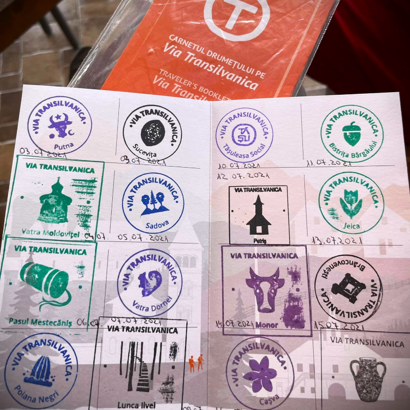
- traveler notebook to get stamps on the route.


Not included:

- other meals

- entrance fees

- organizing the transport of the main luggage from one location to another so only a daily backpack could be used

- optional local activities.

- souvenirs.

MAP

BUCOVINA


HIGHLAND


TERRA SICULORUM


TERRA SAXONUM


TERRA DACICA


TERRA BANATICA


TERRA ROMANA

Tour costs
Ask for price